


Working with NASA might seem out of this world, but a new program aims to show the public that NASA is in agriculture on Earth, not just in space.
Working with NASA might seem out of this world, but a new program aims to show the public that NASA is in agriculture on Earth, not just in space.
The Iroquois County Public Health Department is requesting assistance from the public in the collection of dead birds found in Iroquois County. Since West Nile virus arrived in Illinois at the end of the summer of 2001, dead birds have been important indicators of West Nile virus activity. W…
SPRINGFIELD – Chronic wasting disease has been detected in Ford County, expanding the geographic presence of the infection in free-ranging deer populations in northern Illinois, the Illinois Department of Natural Resources (IDNR) announced in a news release May 1.
SPRINGFIELD, IL, — Iroquois County has been issued a final property assessment equalization factor of 1.0000, according to David Harris, director of the Illinois Department of Revenue (IDOR) in a news release.

(Family Features) If you have asthma, you know that symptoms can come on quickly, then worsen.
Mixed clouds and sun with scattered thunderstorms. A few storms may be severe. High around 75F. Winds SW at 10 to 20 mph. Chance of rain 50%.
Clear skies. Low 53F. Winds WSW at 5 to 10 mph.
Generally sunny despite a few afternoon clouds. A stray severe thunderstorm is possible. High near 80F. Winds S at 5 to 10 mph.
Chance of Rain: 47%
Sunrise: 05:41:18 AM
Sunset: 07:54:05 PM
Humidity: 71%
Wind: SW @ 16 mph
UV Index: 6 High
Clear skies. Low 53F. Winds WSW at 5 to 10 mph.
Chance of Rain: 24%
Sunrise: 05:40:10 AM
Sunset: 07:55:06 PM
Humidity: 50%
Wind: S @ 10 mph
UV Index: 8 Very High
Cloudy with showers. Low 54F. Winds NE at 10 to 15 mph. Chance of rain 60%.
Chance of Rain: 41%
Sunrise: 05:39:03 AM
Sunset: 07:56:08 PM
Humidity: 78%
Wind: N @ 17 mph
UV Index: 5 Moderate
Partly cloudy skies. Low 43F. Winds NNW at 10 to 20 mph.
Chance of Rain: 5%
Sunrise: 05:37:58 AM
Sunset: 07:57:09 PM
Humidity: 55%
Wind: NW @ 11 mph
UV Index: 8 Very High
Partly cloudy skies early followed by increasing clouds with showers developing later at night. Low 48F. Winds W at 5 to 10 mph. Chance of rain 50%.
Chance of Rain: 21%
Sunrise: 05:36:55 AM
Sunset: 07:58:09 PM
Humidity: 56%
Wind: NW @ 16 mph
UV Index: 8 Very High
Clear skies with a few passing clouds. Low 44F. Winds WNW at 5 to 10 mph.
Chance of Rain: 15%
Sunrise: 05:35:53 AM
Sunset: 07:59:10 PM
Humidity: 51%
Wind: W @ 10 mph
UV Index: 7 High
Partly cloudy skies. Low 51F. Winds SSE at 5 to 10 mph.
Chance of Rain: 15%
Sunrise: 05:34:52 AM
Sunset: 08:00:09 PM
Humidity: 52%
Wind: WSW @ 11 mph
UV Index: 8 Very High
A few clouds from time to time. Low 53F. Winds SE at 5 to 10 mph.
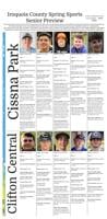
Several Iroquois County track and field teams competed at the Vermilion Valley Conference meet in Westville Thursday.
In baseball
Clifton Central track and field teams competed at the RVC meet at St. Anne.
Iroquois West track and field team members competed in Monday’s Gibson City Melvin-Sibley’s Mini Meet.
Watseka High School hosted a boys’ track and field triangular meet with Herscher and Manteno Tuesday in Watseka.
The Times-Republic mobile app brings you the latest local breaking news, updates, and more. Read the Times-Republic on your mobile device just as it appears in print.